Maps for the first offices and delivery warehouses up until the year 2,010

The circles represent areas that have a high concentration of the population experiencing misery.  There are not enough resources for these people to support even a minimum decent standard of living.
The colors within the circles differentiate responsibilities of action and control as denoted in the table below:

Fifteen (15) of these sites have shipping facilities to facilitate delivery of humanitarian aid, including food, medicine and the means for purifying water.


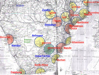
(click on map for large version - 135 k)
_ Warehousing Facilities, to act regionally per instructions of sub-offices.
- Sub-Control office that controls designated areas with warehousing and responsibilities for the country that they represent.  (In case of Mozambique, there are 2, one in North and one in South
- General Control office warehousing, purchase office & payment office (Johannesburg)
All of these circles represent a 200 mile radius service area.  Our trucks can leave in the morning, drop their supplies and be back late in the evening.  Road facilities are acceptable  within these areas.  These outlets are centered within the most densely populated areas, comprising a total of approximately 80-90 million people.  As you can imagine, this is a huge undertaking requiring tremendous resources.  It is in serving these populations, however, that provides our best opportunity to raise the highest number of people out of the depths of despair and starvation.